Maol Chean-Dearg
(Bald red head)
North West Highlands of Scotland
Grid NG 92456 49893 Munro No 247 height 3061 feet 933m.

Access point Coulags-about 6km west on A890 past Achnashellach railway station.
Route: Summary
| Route Distance: 16.9 km | Estimated Time: 6 to 7 Hours | Without a jet pack. |
| Total Ascent: 1030 m | Total Descent: 1030 m | As some writers time would suggest. |
Elevation Profile

Maol Chean-Dearg from the gaelic meaning (Bald red head)
Maol meaning :- rounded headland, mull; promontory.
Chean meaning :- head
Dearg meaning :- red
Sore feet factor:-

 ish
ishVery rocky path higher up.
Bog Factor :-

Boggy along the glen path in places.
Scare Factor :-

If you don't like steep boulder fields.

Would come in handy along the glen.
Where to start, at the begining of course.
5.30 am 23/10/11 I drove round and picked up Brian and we set off in my car from Alford for Achnashellach near Loch Carron in the west highlands of Scotland
Up over the Lecht this time and on to Inverness . Had a plan to arrive at the Tarvie services about 7.30 for our bacon rolls and tea. Timed it to a T so to speak, got there just on 7.30am and we got our bacon rolls and I had a tea, Brian having coffee. This was my breakfast as if I eat at 5am I would get very hungry by 8am . Dinosaurs have a big appetite you know. There was another guy at the services waiting on his mates to go fishing for the day. They soon arrived and tucked into bacon rolls too. Fed and watered Brain and I set of for Achnasheen station along the A832 as there are very clean toilets there and we always stop there. The ducks at the duck pond seemed to think we were going to feed them when we arrived as they came running over to us.

After Achnasheen you turn left at the roundabout on to the A890 heading for Strathcarron. A good road for a while but then it's single track.
You will come to Achnashellach after a few miles and the station sign. Keep going till you get to a level crossing and carry on about 3 and 1/2km after it and you will come to a stone bridge, cross the bridge and just round the corner there is parking for about 5 cars on the far side of the road.

Car park.
There must be a fair few cars have bashes at this bridge as the crash barrier leading round the corner to it has bits of car strewn all along it.
Walking now go back over the bridge and you will see on your left the right of way sign at the start of the path.

This is the start of the walk up Corie Fionnaraich leading to Maol Chean-Dearg. It was quite cold when we started and I almost dug out my gloves did get my tammie on to keep the old nugget warm. It warmed up as we climbed higher on the path.
Through the gate on the landrover track and you will come to an entrance in a short distance. Keep left here as the landrover track goes to a house. Look for the arrows on the left hand post pointing the way.

Brian pointing to the arrows.
The path dips down by the river and it's quite boggy and slippery as you have to walk across tree roots.

You can get by on the roots at the side without getting too muddy. After you clear the trees you get this view on a clear day.

Maol Chean-Dearg sticking up behind Meall nan Ceapairean on the left of shot. To the right is another Munro, Sgorr Ruadh. You will come on an estate sign just along the path a short bit - giving information about shooting.

There is a very good path though quite boggy in places till you start to climb.
First challenge is a ford with stepping stones to get across would be difficult if the burn was in spate. Wellies would help here.

Photo by Brian.
Me trying not to slip and fall in for a change.
As you climb the path is a stone man made one and could be slippy in the winter if ice formed on it.

Looking back down the path.
You will come to an old fence with the gate missing next.

The path still climbing after here is solid rock

Brian on the solid rock path. Just over the rise you start to head down towards the river and a foot bridge across it.

Brian heading for the bridge. This is a wooden plank bridge with no guard rails and could be slippy when wet or icy.

Brian crossing the bridge over Fionn-abhainn.
Over the bridge the path follows the river on the west bank a good path not too boggy and in a short distance you come to a memorial.

Brian at the memorial.
If you are a mountain biker reading this, the path has biggish boulders in it and although we did see bike tracks it might get quite difficult for a biker. After the memorial you will come to the bothy it's a cracker maintained by the MBA and well looked after. We scored as there had been people staying the night and the stove was still warm and it was nice and cosy in the lounge area.

Coire Fionnaraich Bothy. Picture by Brian.
This is shut to the public between 1st September to the 20th October as the estate uses it then, but open the rest of the year.
We stopped here for our fly cup and sat by the stove.

Me parked by the stove - nice and toasty.
It took us about one hour to get here and had a short break. Good visibility here.There's 2 spades to dig holes ( the bothy toilet)

Go dig a hole if you want to go.
2 bedrooms upstairs and another room downstairs so quite a few could kip here.

The upstairs bedrooms.
Had to lose a layer here as it was getting warmer. We left the bothy and headed on up Coire Fionnaraich the path is still good but a with few really boggy bits. You come to an odd looking standing stone which has a legend attached to it. This is the Clach nan Con-fionn (The Stone of Fingal’s Dog) where the legendary Fionn mac Cumhaill reputedly tethered his Hell hounds while hunting.

Clach nan Con-fionn.
But if you see it from side on it looks totally different.

Brian dicking about on top of it. You can use your imagination as to what it looks like.
Not far past here you will come to a fork in the path, the left heading up to Moal-Chean Dearg and beyond and straight on heading to Annat etc.

Brian pointing the way. The relentless grind up starts here, on rocks all the way now.

Maol Chean Dearg.
The right hand peak is the top. The path takes you up on the left had side of the left peak and then up from there.

Brian leading the way as usual. Graham and me like to call him dot. (as in dot on the landscape) as he is always well in front. He can be hard to keep up with at times. The old dinosaur only has one speed (steady) and I get there in the end.
Brian marched on up the hill not stopping till we got to the bealach a' choire Ghairbh at 578m and had a wee rest to take a few pics.

Brian checking the map. The path straight ahead up the rocks. This is one of those up over a rise and you find another rise hills. 3 sets of rises from here to the top.
The path gets steeper and rockier from here up to the summit.

Brian heading up the first rise.

Next bit on the path up not too bad to get by in the dry.
It levels out a bit after here and you can see the next rise in the distance across the boulder field ahead.

As we crossed the boulder field we started to get view of Beinn Eighe and the Torridon ranges.

We had just climbed Beinn Eighe 2 weeks ago and had a great day there.
Bigger boulder field ahead and steep to the top.

Up there to the top.
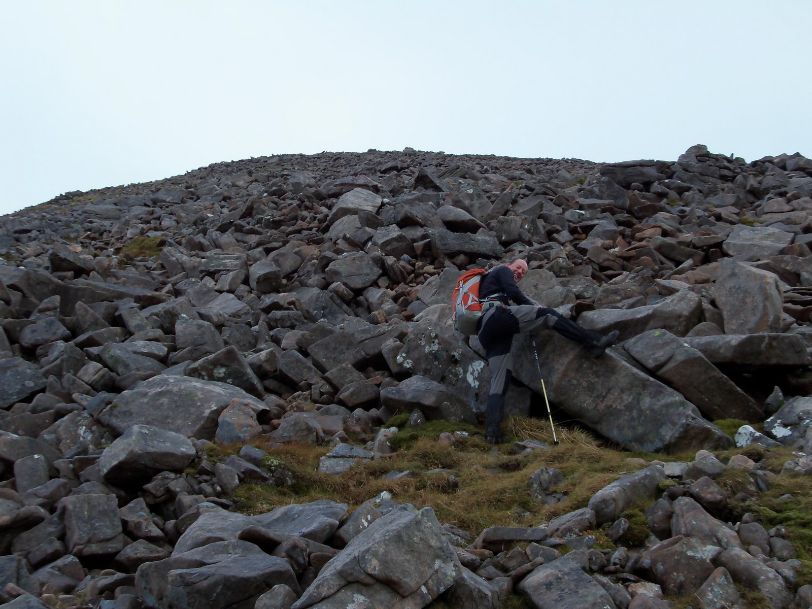
Brian clowning around on the boulders.
After this Brian changed into get to the summit mode and flew up the hill side as usual but I just plodded along at a steady pace.

Brian in get to the top mode.
As you come onto the flatter bit there are a few cairns
5133

Munro No 146 for me No 193 for Brian.
A cold wind from the south blowing across the top, got the jacket on and we took the usual photos and got in behind the cairn for lunch.

Me on the summit cairn Maol Chean-Dearg

Brian on the cairn.
It was nice and clear and had fantastic views in all directions with the three Torridon masses in front of us.

Torridon Munros 6 in all, 2 on each.
Beinn Alligin left, Liathach centre and Beinn Eighe right.
Liathach is the brammer. Haven't climbed Beinn Alligin yet but looks like a good day out.
Liathach pinnical side path is a scary place to be on a nice day. When Brian and I climbed it we met a very scared man
coming back down the west end not daring to tackle the pinnacles or bypass route. Another blog about that one some time.
I'll just show you in the next photo where the pinnacle bypass path is roughly.

Scare factor on the Liathach walk.

One of the scariest places I have been including The Cullins.
Yes and promised to go and climb it again with Graham, think we will go over the pinnacles next time.

Me on Liathach pinnacle bypass path. Photo by Brian - and yes that is a 2,500 foot drop off to the right.
I will put a link to the rest of the photos on Flicker at the end.
After lunch Brian and I set off back down the way we came up stopping at the bothy for our fly cup and then back to the car and just as we got back to the car it started to rain, just after 3pm. Timed it well 16.9km in 6hours-ish not too bad going.
We drove back to Tarvie services and stopped for our tea - pie and chips with a cup of tea £4.30, not a bad price.

Cafe is on winter hours now after the clocks went back so we will not get breakfast here now.
After our tea drove down to our usual watering hole The Boat Inn at Boat Of Garten for a pint.

Brian has many such photos.
Home over the Lecht but got held up coming down into Corgarf as there was a lorry stuck in the middle of the road.
He did not seem to be able to get a forward gear. A tow truck pulled him forward and then he got reversed in to the side of the road. The police were there directing traffic and we got past after 15 minutes or so. Home about 7.30 after another great day out.
Brian's photos on Flicker link http://www.flickr.com/photos/44907198@N00/sets/72157627837799799/
My photos on Flicker link
Dino60
No comments:
Post a Comment