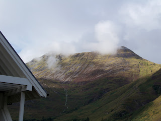
Beinn Sgritheall the lonely mountain. 17/9/11 Part one.
This was to be a birthday trip for me and Pauline my wife. I had asked my other two walking buddies if they wanted to come but they both had other commitments. Up at 4.30 to leave at 5am nipped up to the kitchen and stuck on 2 eggs to boil while I grabbed a shower. Hate eggs that have been boiled the night before as they've a tinny taste to them. So always boil your eggs in the morning they taste better. Showered back up to the kitchen and made some sandwidges for the piece. Had packed the car the night before with most of the stuff so just the food and coffee and rucksack to bung in. At 5am we set off north for the A96 as it's quiet at this time in the morning, up over the Suie hill from Alford. It was pea soup at the top with the fog really thick. On down to Leslie and the fog cleared up at Huntly then a left onto the A96 for Inverness . Stopped at Keith for diesel filling the car up for the trip ,2p cheaper here than Alford. I couldn't get a Daily Star to read as they were not in yet. Tank full to the brim and me wallet £30 lighter we set off for Inverness taking the Mulben road to avoid the road works at Fochabers as they are building a by-pass at this time. Got to Inverness about 7am and deliberately took the long road 10 miles longer, you might ask why. Well I will tell you, bacon rolls. North over the bridge heading for Tervie services near Garve. Timed it just right for my breakfast, a large cup of tea and a bacon roll for just over £3 stood and talked to the proprietor as I ate my yummy bacon roll. He opens 6 am to 6pm Monday to Saturday and 8am to 5 pm Sunday in summer time a bit less after the clock changes. The bacon rolls are so good I had a second one, one and a 1/2 would have been perfect 2 was a wee bit too much but I scoffed it down any way. Hey this was a sort of holiday day out and you always eat more on holiday - well I seem to.
By the way if you're a truck driver reading this there is room to get an artic into the car park and off the road.
A wee bit stuffed now back to the car and on to Achnasheen for the toilets at the station. Got in first to the gents before the rush, well one other bloke was in a hurry to go but I beat him there. Pauline grabbed her breakfast when we were stopped at the station car park. Relieved set off west for Strathcarron and the turn off to About 2 miles out off Achnasheen the Pauline said "did you see that", "what" I said - "3 Golden eagles just beside the road", "No". Hit the brakes and got the car turned round and headed back, got stopped just near one on a fence at the road side and just as the camera fired up the b****y thing flew off. Watched them fly around to see if they would land again and yes it did, a good distance away but I have 15 time zoom on my camera so I got this wonderful fuzzy picture just before it took off.
A Golden Eagle
We have seen a lot of Golden Eagles this year but never managed to get a picture of one yet. I will try and get a better picture next time but they don't sit still for long.
The famous 7 miles of single track road ahead now, not too bad this time only met a few cars on it - makes a change. Left at Strathcarron and onto Panorama of the east end of Loch Sheil with the Five Sisters mountains. (still to climb them).
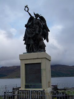
Photos taken and a few midge bites later it's up the road in 1st gear for the next bit as it was so steep and twisting. Probably would have managed 2nd if I had wellied it earlier. The road climbs up to about 390m and then down to Glen Mor with quite a big drop on your left as you descend back to sea level when you reach Glenelg there's one of the most impressive war memorials there is. This may be due to the fact that Valentine Fleming the writer's brother is named on it his father being a laird up here at one time.
A bronze statue on top.
Up hill again as you leave Glenelg heading for Arnisdale with good views of The Sound of Sleat and Skye as you travel round the point, single track road along here about 10 miles of it to Arnisdale and back to sea level again. We arrived at Arnisdale just about 10am . There is an old worn sign pointing the way between the houses to Ben Sgritheall. Parked the car in the opening between the houses and got kitted up for the walk being watched by an old bloke sweeping his doorstep. Probably thinking here's another one! The post office is just to the right of the opening it's a shed out the back of a house.
Arnisdale post office.
Kitted up and ready to go I got my picture taken at the Beinn Sgritheall sign.
Beinn Sgritheall that away.
Said bye to Pauline as she was off exploring the shore line for the day.
The path is not very clear and I sort of went wrong (what's new). The path goes right of the hydro pole in the picture but I saw a track off to the left going up through the bog behind the houses so I followed it and it was a good thing I'll tell you why on the way down.
The path is right of the pole and up through the trees.
I was actually following an agrocat tracks through the bog.
Faint track ahead.
Just after the trees in the picture I spotted the track off to my right and headed over to it. Not too steep at this point but that would soon change. There are 2 fast flowing burns to cross about 50m apart not too wide but it was slippy on the rocks and I did not fall in them for a change. Graham will be disappointed!!
Second burn to cross.
I could see the path climbing steeply up a shoulder ahead this would be a slow climb.

The dark green line to the right of the gully is the path heading up to the bealach.
Now about here is when trouble started, not midges but worse armour plated sheep flies. If you have never encountered them you're lucky. You can whack these sods as you would an ordinary fly the difference being a fly will be flattened and toast but the sheep flies are something else. If you whack one of these it just looks up at up and laughs. You have to physical pull the damn things off and they seem to have claws to hang onto their pray. I could feel the hairs on my arm being pulled as I removed them. You can't even flick them off as they have such a hold. I had put Deet 50 on and it did seem to stop them from biting me. They were hiding in the ferns and tall plants waiting to jump onto their pray as it passed. It was a bit like in Jurassic Park
The path is very eroded and steep in places after you cross the second burn. Fly land ahead and it's steep.
There is an old iron fence that more or less follows the path up which you could use to navigate in the mist if you had to. As you climb your view over Loch Hourn and Knoydart gets better.

You come to a small valley and a good place for a fly cup only had to fend off two sheep flies here.
Stopped just at the back of this gully for my fly cup and something to eat. Was not hungry but forced myself to eat something after past experiences with not eating enough on a walk. I could see right over to Skye from here and Knoydart but it had cloud beginning to form over it.
I had been walking wearing just a t-shirt up to now as it was quite hot.
The only way is up from here as the song says. Steep climb out of the gully with a bit of scrambling on the rocky path in between two burns.
The path is middle of shot going up by the big rocks.
After this it gets quite boggy and the path disappears a few times when you get to the start of the bealach. When I got to the start of the Bealach I lost the path so I hanged a left or west and headed up to the first top Coire Min. Wet boggy grass at first not too steep but yep that would soon change, no I lie it was steep.
I zig zagged as I made my way up through the grassy slope to take off some of the climb, also cut across at a angle on the slope as this took off some of the steepness.
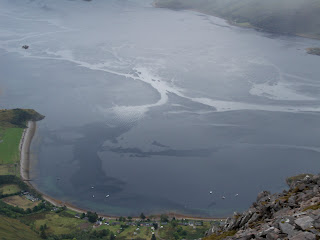
As I climbed higher I got a great view of the currents making patterns on Loch Hourn Knoydart at the far side of the loch.
It just keeps getting steeper, stepmaster 6000 ahead up through the rocks.
The top of Corie Min had a little bit of cloud on it as I came up the last of the grassy slope. 
The last bit of grass to climb.
Stepmaster path ahead. This bit is tricky, the path disappears a lot up through here. On one of the stony bits I had to get off to the side onto bigger rocks as I was not making any progress up, mostly down at that point.
It gets better.
Well not really but a few bits of path appear now and again as you make your way up this bit, quite close to the top now.
Arinsdale and Loch Hourn straight down. This is the view looking down just before the top.
I could see the cloud coming across from Knoydart and made a push to get to the top before it arrived. Cairn ahead and still in the clear for now. I slogged up on to the cairn to beat the mist rolling in, a wee bit tired now so time for a break and some nosh.
Are we there yet? Nope that's not the Munro top its just over 1km further on hmm.
Stopped for something to eat and put my jacket on as it was getting colder now.
Stopped for something to eat and put my jacket on as it was getting colder now.
I could see the cloud over Knoydart heading my way and bringing rain with it. Beinn Sgritheall was still in the clear at this point.
Beinn Sgritheall.
As I was sitting at the cairn a, (bad word) migraine started, seem to get them often when I have been climbing up steep hills and have got too hot or there has been a really cold wind. Have really good pills for them now which stop them in about 20min. Took my pill and stuck my sunglass on to mask the light. Got the rucksack packed and the rain cover out over it. Did not think the rain would come too much so I did not put my water proof trousers on (mistake there again) but hey what's new. As I walked down the hill with the wind picked up and the rain now battering me sideways my vision was deteriorating with the migraine. I try and line the aurora up with the rim on my black sunglasses to mask it from my view but you can't get rid of it till its killed by the pills. I used to sit and wait till they past but that could be up to 40 minutes and you get pretty cold sometimes doing that. So now I just plod on and that seems to get rid of them after about 20 minutes, that's a lot quicker now. Legs soaking wet from the rain with a migraine I was really enjoying myself now, I don't think. It was one of those what the hell am I doing here moments. The rain passed and I decided I would now put on my water proof trousers although a wee bit late now. I could see a rainbow to the north of me now. My migraine was starting to pass now.

Kitted up as I should have been before the rain I set off along the path for Beinn Sgritheall. You have to drop down to 830m and cross a ridge before the climb up to the summit. By this time the summit had disappeared into the cloud but I could still see down to Arnisdale 810m below me.

Arnisdale down below.
The ridge gets quite narrow as you start up to the summit with a wee bit of scrambling over some rocks on the path, as it widens out there are large rocks strewn across the path.
Close to the summit.
Gets grassy again as you get up to the summit and the broken down trig point.

Summit just up ahead in the mist.
Me at the summit and trig point off Beinn Sgeitheall 974m my 143rd Munro. Up here on my own with the mist down I could not see all that far and it was a creepy place on the top, a bit weird really. This is the first time I have climbed a Munro on my own and never met a soul. This Munro is well off the beaten track and I think only Munro and Corbett baggers would come here.
I had a look out to the west as you can go down that way but as I could only see 30m or so I decided just to head back the way I had come. A trick I learned from Graham who I walk with. In the mist drop you're walking poles pointing in the direction you have come from. So after you have been wandering about at the top and got disorientated in the mist you still know which way to go back.
Quite cold up here in the mist I packed up after taking a few photos and followed a path leading off in the direction I had come up - or so I thought!
Part 2 to come. The wrong path down.
Dino60.


No comments:
Post a Comment