Day 2 the summer solicits.
Got up to see the dawn at 4.20am a little bit disappointing as it was a grey dawn. Never mind Munro bagging to day 6 in sight for the day. I new this would be a big day out. First job river crossing. A little tip never cross a river in bare feet or you will end up in it. Took my sandals and put them on rolled up the trouser legs and set off across Abhainn an Nid. Quite wide but not that deep. Set of at 4.36am.

I had a cunning plan to get to the first top the easy way. By heading across
Am Pollan and up to the belach 650m between Beinn a' Chlaidheimh and Sgurr Ban on a bearing of about 240 degrees from my camp site . The tops were in the mist but the belach was dipping in and out of the mist. The night before I had seen the north end of Beinn a' Chlaidheim and decided to avoid the crags there buy taking this route.
View looking back to camp site and the Land Rover track out on the way home.

It was about 3.6km from camp site to belach but with heavy rucksack and a few stops it took me a while. Stopped at the belach for breakfast Frosties mixed with Corn flakes powered milk of course and a hot cup O tee (dam fine) as it was now 7.20 am

Am Pollan

Breakfast
Now fed and watered I set of north for my first Munro of the day Beinn a' Chlaidheimh the top still in the mist. Pretty rocky up the first bit to the 815 spot height. Having dumped my rucksack as I was returning back this way, made the going a bit easer. Just took my poles and a 1/2ltr of water.

First big up of the day
Took about 1/2 an hour to reach the 815m spot height . Got there and saw a cairn of sorts and went that was easy, till I checked the map about 1 km to got till the summit. Don't be fooled by this top you ant there yet.

From the 815m top you drop down 50m or so heading north passing a few wee lochans. Its my experience in hill walking what goes down has a dam big up after it lol and sure enough bolder field going up.

Last climb to the top.
Getting near the top thinking (I know that's dangerous) I will be first up here on the summer solstice. Wrong again met a young lad who had come up straight from Shenavall just before the top (rats second again). He had left about 5am from Shenavall and told me it wasn't pretty coming straight up. Not much in the 2 routes I was only 1/2 hour behind him and had stopped for breakfast. Had the usual chat about what he had been up to and went our ways mine more up. Still quite misty so had removed my glasses as they were fogging up. Ok I can see a bit with out them did find the top. Munro No 128 Beinn a' Chlaidheimh ya who. Got the camera out with its famous self timer which always takes a pic as your trying to get back to the posing site.
Many of these can be seen on my
Flicker pages at http://www.flickr.com/photos/dino60/

Beinn a' Chlaidheimh summit. 8.36am
Set off back to belach and rucksack in the mist heading south. For sum reason I found it more difficult to find my way back in the mist but I had a secret weapon my trusty Garmin etrex san nav. As you walk it records it on to a line showing you where you have gone. Had to look at this a few times as I made my way back down and remember about downs yep am big up just past the lochans back to 815 spot height. Could have walked a bearing on the compass but if you have it use it I all was say.
Got back to rucksack about 9.40am Fly time. Had filled my flask with coffee when I mad tee for breakfast . Hot coffee and crackers with spreading cheese for fly. Took a good bit of weight out of rucksack as had used quite a bit of water up. I could pick up more water on the way round as I keened it.
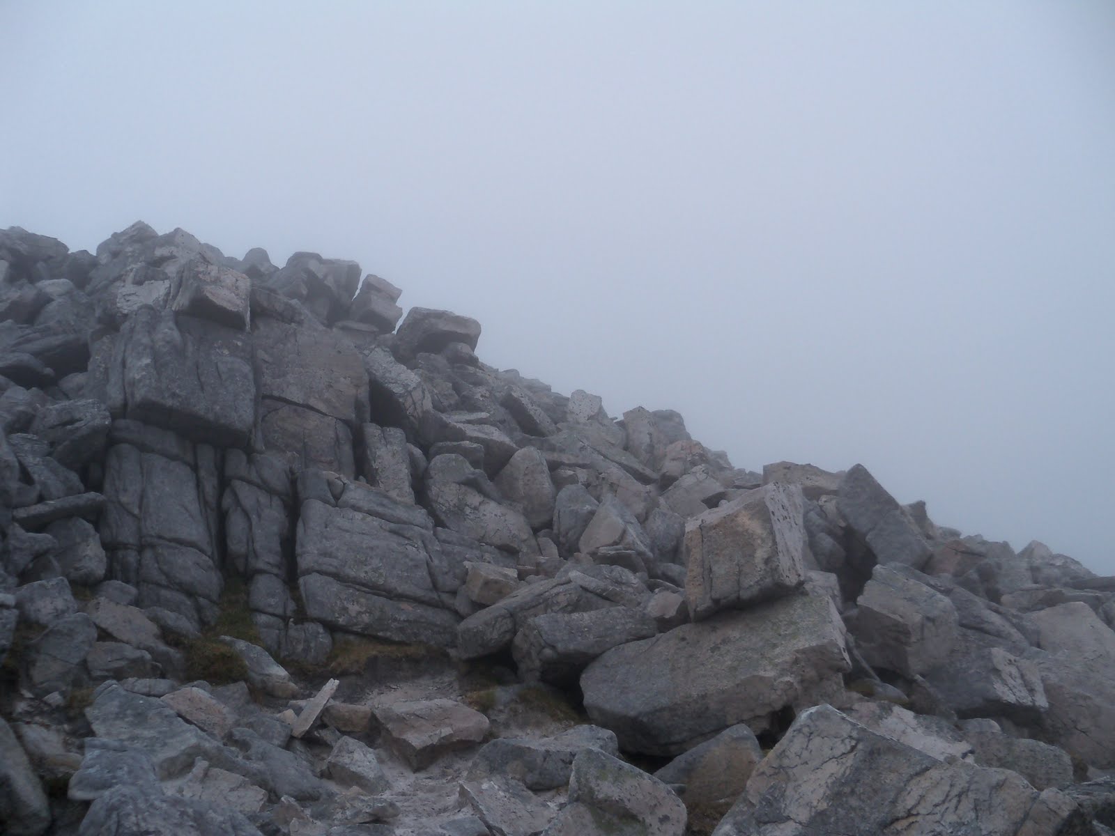
Set of at an angle of about 190 degrees from the belach planning to pick up the ridge of Sgurr Ban round about the 750m contour. I hope you like rocks from here on you will see a lot of them. Rocks all the way to the summit. As I was climbing up I noticed of to the east what looked like a big cairn. Took a detour to see what it was. Turned out to be a mountain shelter, some kind sole had built it with a low door facing south. It is around NH 061,749 if you ever get caught in a storm it could save your bacon.

Shelter

This is what it looks like in the mist.
Heading 230 degrees from shelter the top is around 750m up the rocks which are smaller here and the going is easer. I reached Munro No2 of the day at 10.59am . My 129 Munro.
Pretty bleak place in the mist as its quite flat round the cairn.

Just having a wee sleep.

Sgurr Ban Cairn.
Due to the fact that I could not see far in the mist and the lack of any path to follow I got the old compass out and worked out a bearing which would take me down the south ridge and on to the bealach between Sgurr Ban and Mullach Coire Mhic Fhearchair. 210 degrees ish.

That way south.
You drop down to about 810m not to steep on the way down.
And then you see the north slopes of Mullach Coire Mhic Fhearchair and take a deep breath. Let the dance begin. Very steep loose scree thought big boulders 2 steps forward and 1 back. This climb is a sod. Of course this would be the biggest Munro of the day at 1019m I let you look at the pic it tells it all.


Spot the path above.
After a big effort I reached the summit Munro No 3 12.22 pm a bit chilly here.


Mullach Coire Mhic Fhearchair summit.
Just to make thinks even the path down to the south is steep to with giant rocks just for fun.
Looking back up path go's to the right of big rocks.
Now just after descending this lovely bit I met a guy with 2 collie dogs heading up here. Only thing one of the 2 dogs had 3 legs and believe it or not it was in front of the younger looking collie dog with all 4 legs. This guy looked fit and was bounding up the hill side (not jealous really). Stopped for a chat he seemed to have come from over by Slioch way and was going over a couple of the Munros behind me with the dogs and then back.
Good news after descending Mullach Coire Mhic Fhearchair you see Meall Garbh 851m which has a stakes path running along the north side of it. Roughly following the 750m contoured which take you to the Bealach Odhar at the start of the climb to Beinn Tarsuinn. Dont have to climb it.

Path just to left of shot.
A we bit bogie as you cross Bealach Odhar and head up the western slopes of Beinn Tarsuinn. Got to see the top before the mist came down again.

Beinn Tarsuinn.

One of the easer climbs of the day to the summit of Beinn Tarsuinn. Be careful when you reach the summit in the fog. Big drops off to the north and west, which you can't see in the mist. Reached the summit 13.45 pm Munro No 4 for the day. The mist was coming and go in. Finally got some views.
Mist down again as I pondered which way of the summit, map out and study. Caught a glimpse of a small lochan to the west and orientated the map to match. south west would be a good idea and set of. The mist lifted again and I could see the ridge and pinnacles of to the west.
Found a path and followed it down to what they call the tennis court (fun playing tennis here).

Path down from summit.

Tennis court with pinnacles in distance.

More good news for the fainthearted, you don't have to climb over the pinnacles there is a by bass path to the south or you can go over the top. I took the bypass path.
Headed down to Pollan na Mulce with the aim of crossing it and on up A'Mhaighdean on the west side. Stopped for something to eat and get more water from a burn. This is the point where I took in the big picture so to speak. I was now at the place which is said to be the remotest point in Scotland 3pm and if I did the other 2 I would have 3 river crossing to do. By the time I got round I would be crossing rivers in the dark. Made my mind up to go the short route down Gleann na Muice. It would be all down hill (i wish) and only 1 river crossing.
Set of to the north west side of Pollan na Muice as there are cliffs across the north east side, aiming for east side of the river. A bit bogie from her down. took last photo of Beinn Lair Corbett across Lochan Fada and set of down the glen.

Beinn Lair
Let the trudge begin. It a long way down this wet glen with a few scitie bits enroot. Just about ended up on me backside a few times. After a couple of hours I decided to stop for hot food. I had taken camping boil in the bag meals with me. Water required for pan. There was a small burn in about a 2 foot deep trench which I could get the pan filled up in. Saw a rock in the we burn to stand on and went for it, next move slipped of the wet rock and foot in to burn lol.(It gets better). Have Vango 3 set camping pan with clip on handle. Attached handle to side of pan and dipped in the water to fill pan. Lifted the lot up out of the water only to have the pan float of down the burn a bit. Retrieved pad still standing on wet rock, attemp2 pan came up out of burn still attached to handle wait for it. Caught a big spider and web as I lifter the pan up was not expecting that, dealt with that and got the pan full climbed out or the burn and headed for the stove. Pan fell of the handle just short of the stove, back to burn again. Success pan now on stove and heating water ya who. Dug out the chicken in some kind of a sauce, which I had had at home for a while and opened the outer packet. Best before April 2011 what next. Sod it in to water to cook for 6 min. A bit cream cracked now with the days walking rested my head in hands only to fall asleep for a we while. Woke up and retrieved my tea form the pan delicious ish , an way I felt better after forcing it down and a cup O tee to.

Gleann na Muice
Set off again keeping to the east side of the glen which seamed to go on for ever and got boggier as I went down it. Approaching the end of the glen I cut of the corner of Beinn a Chlaidheimh this involved more up hill. Could see Larachantivore and Shenavall across the strath and pondered if that would have been a better start and finish point. Think it would be if you were going for the 6 hills but a you have a 60 foot wide up to your knees river to get across if you go straight from here. Marched on heading for Achneigie across the river. With one more stop behind a big rock out of the wind for a cup o tee. Reached the river just west of Achneigie. A ha rocks all the way across will I wont I time. Went for it across the rocks taking my time no problem till the last rock, the side or it was sloped got one foot on no problem second foot had other ideas. Slipped of rock in to river I landed on top of rock foot wet again. Recovered an up on to back dry ish land. Only 1km to tent along Land Rover track. plodded along the track to the tent, arrived at the tent crossing the we burn to my island 15 hours after I left and had covered just over 28km. All the other tent had gone so I had the place to my self. Contemplated packing up that night and heading to car. Stayed in tent. Did I tell you it had been raining since 3 ish. Got in to tent read for a while and of to land of nod. End of day 2 Day 3 fun still to come.
Wow! Big day. Well done..
ReplyDelete