Thursday, 11 August 2011

A'Mhaighdean and Ruadh Stac Mor by Poolewe. Part 2

By popular request here's part 2  ..... well 2 folk wanted to read part 2!

A long walk in July.

A'Mhaighdean and Ruadh Stac Mor by Poolewe.

Part 2 - The walk out.

  Now standing on the bealach between A'Mhaighdean and Ruadh Stac Mor after summiting A'Mhaighdean it's around 5pm in the afternoon, having a cup o tea trying to eat something as energy levels low at this point. Having difficulty eating though as my mouth is very dry, it's a bit like trying to eat a brick. Oh well have to see how I go, not much water left now and still Ruadh Stac Mor to climb. Decision time, will I climb up and come back down the same way or take the rucksack with me and find a less steep way down?
                                                        Up through here.

   There is a lot of loose rock as you climb up and quite a steep path at the bottom. Looks tricky to come down so take my rucksack with me and find another route down then. Kitted up and set off, will-power now kicking in got to get a move on to get back to car by dark. According to my gps log I set off from the bottom at 5.00pm and 26 minutes later I was at the top some how. (will-power there I think)
    The first bit is real steep as you can see from the photo above and then there's a boulder field all the way to the top.

                                                    This is the second bit, still steep.

    I always find it easier and quicker to go up through boulder fields, maybe its because you have your head down looking at your feet so much that you don't realise how steep the bit you are climbing actually is. But it's different on the way down a boulder field as you need to look a bit ahead then. Anyway 26 minutes to the cairn which by the way is a mess. Someone built a rock and cement cairn up here.  

Not sure how I got up here so quick but I did. Took a few pictures at the top.

                                                  Looking back over to A'Mhaighdean


  If you look at the top of this photo just left of centre there is a small loch, that's where the car is, just a tad away you could say.
http://www.flickr.com/photos/dino60/5995803768/in/photostream
 The photo above will be bigger on flicker link above.


                                                   Me at the top of Ruadh Stac Mor.

Put my climbing hat on to come up the steep side, I use it as a bike hat as well much more comfortable than a bike hat. Got to keep what little brain I have in one piece if I fall.
   Route finding time. On the way up I had looked along to the west and the side of the hill looked less steep than where I came up, Yep, should have gone to Specsavers. Made my way west along the ridge for about 1/2km descending all the time top was 918m and came down to 825m on the ridge. It's an easy walk off to the north but would add some distance on. I set off South down the grassy face cutting across at an angle to take the steepness off. Walking poles are good at this point to keep you upright.

 This would take me back onto the path at 667m, and it's steep down again. And of course there's crags as you go down to avoid, wouldn't like to try this in the clag without being able to see where I was going.

                                             This is where I came down. Ruadh Stac Mor

   On the path now, 5.51pm got to the point now where I could not drink water without feeling sick , but I learned on one of my other big walks to walk with my mouth semi full of water for as long as I can. This took the dryness out of my mouth. Not much water left so had to ration it. Right leg-it as fast as I can. Into go home mode now, but it can get a bit painful doing this. Good it's mostly downhill on the way back, boy is it a long way.
   First task get to the stream on the path up Sgurr na Laocainn for water only 4km from here. Head down and off I go looking for markers like the cairn at the end of this path where it joins the Fisherford path. It's a good feeling when you get to something you have marked off in your mind. 2km to cairn down a not too bad path, zigzags a bit with one river crossing off the outfall from Lochan Feith Mhic-illean.

      This pic is taken just beside the cairn looking back to A'Mhaighdean and Ruadh Stac Mor.

 Only 2km to running water. Right you're thinking you have just crossed a river why not get water from there? Thought about it but it was just out of a small lochan and would probably need some treatment and the water kit I had takes a while to work.


 To save time I marched on down to the fast running water, which unless there are loads of sheep about is usually okay to drink straight away.   


   Legs working on automatic now (plodding) got to the burn 6.50pm, fill up with water 1 ltr should be enough to get me to the car. Still can't drink and my mouth's very dry, I keep using the water in mouth technique to keep my mouth moist. Total distance I've covered to here 35km.


  Lets get down this hill to the causeway at the Dubh loch. Off I plod, it's still quite steep down to Carnmor, I had intended checking out Carnmor barn on the way back down but sod the extra 400 yards and walked past. 
                                                                     Causeway

 The path from Carnmor to the causeway is a bit of up hill but not too bad then it takes you onto the pebble beach which will slow you down - it's a sod to walk on.

7.24pm and time for a stop - last of the tea. Tried to eat a bag of crisps, hmm it's like eating sandpaper so gave that up for a bad joke. The midges are at it now in the evening and there's very little wind to keep them away. Quick bath in Deet50 to try and keep them at bay.

Got to get going as it'll be dark around 10pm tonight.

Tea drunk, which I had made too strong for my liking but it's all I had, I set off for my bike across the causeway (another mental marker passed). Then along the end of Fionn Loch with a bit more pebble beach to navigate.

           Next marker a cairn at the turn in the path at Polt Fraochain  and 38.8km into the walk.

 Turn right here and then across the wooden bridge the path makers had put in for daft people like me doing this short walk.

I like the people that build things like this to help us out.

 Next mental marker river crossing about 3 km ahead, midges having a go if I stop now so just kept walking.                
                                
                                   Path climbing up from the loch now towards river crossing
  
   Reached the big rocks just before the river crossing where the bloke left his bike another tick in the brain. A big down and up to cross the river and across the stepping stones. Don't know if you would get across if it was in spate but you could take the old path round higher up.


  8.20 pm as I cross the river and I devise a cunning plan not to get eaten by midges when I get to the bike.

Bike at end of this lochan, reach the bike round about 8.30pm and throw my rucksack down quick and dive into it, wait for it grab my midge net which I bung on extra quick.
 I had put the bike a bit off the path so it would not be seen so have to rescue it from the heather and the bits and pieces I left with it. Put the walking poles into rucksack along with pump, tools and puncture repair kit. My right hand now had a burst blister from the walking poles.
   Lost a bit of weight out of the rucksack in the morning by leaving some stuff here. Cloud of midges round me now hungry little sods and I am their tea.

(not if I can help it.)

 Decide to push the bike for a start as it was uphill with midge net 1/2 pulled up. Legs not too bad at this point I've no idea how, 42km covered now. A major mental tick getting back to the bike.

                                                Looking back to lochan where bike was.

   Big hill ahead I remember coming down it in the morning with the brakes hard on. Got to the top and on to the bike woohoo off the pins for a while. Did not put hat on at first but that did not last long. Picked up a bit of speed on the down hills, but there were all the stone drains along this bit so had to stop for them about 50 times (well it seemed like 50 times). A few big stones on the path and I was having to raise the peddles high to miss them. Until then the peddle caught a big stone stopping the bike dead but not muggins he carried on forward managing to stop before soft fleshy bits ramming into handle bars (use your imagination). Put the hat on at this point not sure why (much).
   Next mental marker the cairn at end of mountains. 1/2 rode bike 1/2 walked pushing bike. Till I hit the proverbial wall. Midge net on, clouds of the little blighters round me now still wearing a tee shirt. Could not go any further. Into rucksack to see what was left to eat and grabbed my jacket to put on. Ah ha "cake" and not the sticky sweet one that had made me feel sick earlier, soft country slices don't you love Mr Kipling. Ok had sat on the ground and was trying to figure out how to eat this cake without being eaten my self, still with a mouth like sand paper. Slid the cake up under the net and took a bite with a mouth full of water at the same time. Managed to get the 2 small cakes down with the water. Piece box on the ground I laid my head on it for a rest as I don't think I could have got up at that point. An orchestra of bzzz was going past my ears and all I could see through the net was a foot thick cloud of the little carnivores trying their hardest to eat me. A few got in to the net - but not many. Don't you just love the west coast of Scotland in May to September with no wind. Nowhere I would rather be (much).

A picture from Skye.

                                                Sums it up beautifully, West Scotland that is.

Really dead now, had a wee rest with my little mates all around for 10min or so.

Got myself picked up some how and off I went, cairn ahead and another mental tick or kick by this time.
                                                      You can see the drains in this pic.

    Over the crest of the hill and magic I could see Loch Kernsary and hatched another cunning plan to save me having to walk/bike all the way to the car park at Poolewe.


And a complete waste of time that was, tell you soon.
   Big downhill to the forest gate and a phone signal again. Made a call hardly able to speak to report progress and give eta to Poolewe. 9.30pm 46.6km done not the only thing that was done at this point. 1.1/5km through the forest to the gate I missed on the way in with the light beginning to fade. Downhill through the forest so had the brakes hard on most of the way through to stop going too fast. Got to the big boggy bit and walked through it, stream next had some speed so straight through jumping off for the little up hill at the other side. Down to the gate which I had to open and then it's out of the forest. Feeling a bit better food must have kicked in now. Only 750m to my cunning plan at Kernsary. Now on the way up there was a pickup truck parked at Kernsary and I figured that if I gave the bloke some cash he might take me to the car park. Got to Kernsary and no pickup! Darn I said ? I'll have to bike it.
                                                                       Kernsary.  

   Downhill and across the bridge but it's uphill after it, got off and walked a bit till I came to some sheds.
 
 Back on bike, next stop would be the Letterewe gate just over 1km, got to the gate at 9.50pm and it was open so no getting off here. Light going now and I was heading for a forest so decided to bung my head torch on just in case I met a car. Into the forest at Inveran


 Not too bad along here, mostly downhill and soon was at the horses in the paddock.
  Big green gate ahead and then the tarred road. Had to open and shut this gate.  Chased a few sheep off the road as I cycled along the tarred road heading for the car park at Poolewe.
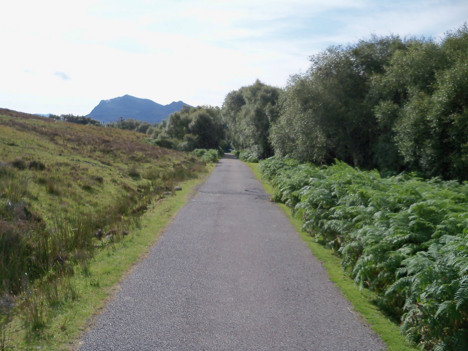

Got to the car park at 10.15pm 54.2km covered. Best mental tick of all.
 3 cans of juice in the car for me to rehydrate. I had lost around 1/2 stone on this walk, pity it would go back on in time.
  Had a rest and a drink but still could not eat much. Changed clothes and got the bike tied onto the bike rack a few midges buzzing around but not a lot so just ignored them. These were the village midges and not as hungry as their country cousins.
  Local pub for a pint of Guinness. Found the hotel and bar but no barman, hiding somewhere. He turned up after a while and I ordered my Guinness he pulled a can out of a chiller and I asked him for "draft". "This is draft he replies" then he pours the can and sticks it under a gas tap. Guinness is best really cold which this was not so I did not enjoy that pint and left 1/4 of it - not like me.

   Enquire as to the price of staying the night. "£49" came back and I said for a room. "No per person". A bit pricy for me. Set off for Achnasheen in the dark now and the single track road between Gairloch and Kinlochewe. Be about 11pm now and we must have meet the whole population of Gairloch on this single track road coming home, had to stop at nearly every passing place to let them by.
  Got to Kinlochewe and the wide road and not a soul to be seen. Pit stop at Achnasheen station.
  Still awake drove on to Contin not much traffic now. Reached Rogie Falls and had to stop, big lay-by here pulled into the darkness and stopped for a sleep.
  Feet down through the peddles managed to get stretched out and pulled the headrest off for a pillow had a blanket in the car to get under. Fell asleep for 2 hours woke up round about 2am and set off for home.  Got to Inverness and plenty people still going about. Headed down the A96 and in nearly all the towns we pased through there were people going about quite a few of them drunk. Got home at 4.45am Sunday morning, wide awake still had to have a cup o tea and watch tv before going to bed around 5.30am  A long day out.
  So tired from this walk did not go hill walking till the next Friday.

    Back to work now so that's the hill walking curtailed a bit.
     
                                                          The end till the next time.
                                                                      Dino60
Ps since writing this, Beinn a' Chlaidheimh has been remeasured and found to be under 3000 foot by 20". When I climbed it on June 21st  it was still a Munro so I am still counting it as a Munro on my tally. This is one of the Fisherfield 6 of which the 2 above are also part part of. Fisherfield 5 and 1/2 just don't sound right some how. So my Munro count will still include it. 283 total. The other one they remeasured and demoted to a Corbett was Sgurr nan Ceannaichean, which I climbed after it had been demoted so I am counting it as a Corbett.

   Beinn a' Chlaidheimh  Middle left hill.
X Munro

                                                         Sgurr nan Ceannaichean sunrise.
                                                                         X Munro


Sunday, 7 August 2011

A'Mhaighdean and Ruadh Stac Mor by Poolewe.

A long walk in July.

A'Mhaighdean and Ruadh Stac Mor by Poolewe.


These being the 2 most remote Munro's in Scotland this would be an epic day out - or how to lose 1/2 stone  in one day.

 We set off from Alford at 5am 30/7/11 for Poolewe in the north west highlands of Scotland. I decided to go up the A96 to Inverness as at this time in the morning there is not a lot of traffic. Got to Inverness in 1 hour 45min no problem and filled the car up with Diesel at Tesco as usual due to the 5p off coupon, which I had 3 of and they had started letting you add them together. Only used 2 and got 10p off.  Still £40 to fill up, this is getting to be an expensive hobby. Set off north over the Kessock Bridge heading over the Black Isle. When we reached the roundabout at Maryburgh, at the side of the road on the verge not 10 feet from the road was a Golden Eagle jumping up and down on something it had killed or was killing for its breakfast, a rabbit maybe didn't stop for a  photo as it was not a good place to stop just off the roundabout. Onward north and it was about 7.30 by now, the Cafe at Tarve was open - great bacon rolls but did not stop today as we were pushed for time. Should have. Turned off just after Garve for Achnasheen and a pit stop. There was a train just leaving the station as we got there, first time I have seen a train at the station here apart from one I was on to Kyle of Lochalsh and back.

Pit stop and put the kettle on the stove. Damned midge's were at it already. Got the Deet50 out for some protection. "Some!" Tea made I dived into the car for breakfast.

   Fed and watered set off for Poolewe turned right at the roundabout at Achnasheen.
The weather was good not a lot of cloud and as we drove north got a good view of Torridon mountains.


               Drove down Glen Docharty and stopped to get a picture of Loch Maree and Slioch.


 After Kinlochewe the road is single track for a few miles as you drive along Loch Maree. Did not meet a lot of traffic on this stretch and we were soon at Poolewe.
There is a walker's car park just over the river on the right but as I was being dropped off decide to see how far along the road you could take the car. Not far is the answer in about 200 yards there is a turning space. Unloaded the bike and kitted up.

The start of the road is a tarred road with a few little ups and downs as you follow along the river. A fellow walker had gone past at I was kitting up and I caught up to him about 1 mile along the road. He was after my bike to get back I think, had a padlock in bag just in case. A couple of Km down the road you come to a big gate still on the tarred road. This is the first of three you have to go through.

 Not long after you go through the gate the tarred road ends and its on to hardcore, its still a very good road though.
 After Inveran you leave the wood and head west for Kernsary  just over 2.5 km further up the road.  Look out for the horse dung (not the word I was going to use) on the road as you cycle along. There are horses in the field just as you leave the wood and they must be ridden along the tracks now and again.

Start to get views of the mountains as you ride along this bit of the track.
You will come on the second gate about 1km along with the sign for Letterewe estate on it saying welcome to Letterewe estate.    

                                    
Once through the gate you cross a bridge over the out fall from loch Kernsary. Remember to shut the gate. There is a little lochan just to the south of the road Loch an Doire Ghairbh and as you look over it the bigger mountains come into view off to the west.

The road twists about a bit here but its good going and you soon see Loch Kernsary to the north if it's a clear day.


Round the bend a bit of downhill to the bridge at Kernsary then turn left over the bridge heading towards Kernsary house.

  Push the bike time here. I found it easier just to get off and push the bike up the hills, a bit of a climb takes you up past the house and round the back is a old bothie painted white and some steel sheds. Look for the light. There is a 3d light on a post to your right as you come to the bothy. It was on in the day so I assume it will be on through the night. The light to the mountains.

                     Or maybe it's a warning that this huge walk is not such a bright idea lol.

5.5 km into the walk now and studying the map. (not hard enough) Once you get up round the corner past the light there is a bit of down hill, on the bike again but not for long though get off and push again. More up a few 100m later.

Now I had read in a blog that a guy had had difficulty finding the path around here that took you to Carnmore. Map out, I would find the path no problem, yep its on the map. Carried on and came to a big hill just round a bend, off and push again.


Pushed the bike up the hill looking at map thinking (dangerous bit) that must be that top to the north 166 high on the map. Hmm I'm going the wrong way  1km up this b'ing hill the wrong way. Checked Gps for exact position. Darn I said ( if you can believe that). Hmm where is that path? On the bike and back down the hill, at least it was all down hill. 1 km later there is a small gate right in front of me as I turned the corner to climb up the hill.

  Think I should have gone to specsavers as the ads make out. A flipping farm gate never even saw it. Leading to the forest. Get me on top of a mountain with a compass and thick fog and I'll find my way about no problem, but for some reason I find it harder to navigate on a track which is on the map lol.
On the right track now just what you need an extra 2km on top of my biggest one day walk this year.

The forest is about 1km across but the road twists about a bit and you have a small river to cross not too deep but about 10foot wide. Flew through it on the bike just getting to the other side as I run out of momentum, only to turn round and see a bridge just 10foot up stream. You can't see the bridge very well as you come up to the river, but if you were walking it would get you across.
Not long after that is a real boggy dip which lasts for about 50feet, pushed the bike through that bit trying to keep on the driest bits. There is a sign just past here asking you to follow the new built path at the cairn 800m ahead.


At the cairn the road turns into a narrow path, a good new path which has been built.
A good bit of up now and you come out of the forest to a gate and the Letterewe wilderness. More up ahead.
Stopped for something to eat just up from the gate and got a phone signal. You get a good view back down to Lock Kernsary from here.

10.30am now and a few flies about but not too bad for midge yet. (Just wait)
Push the bike to the top of the hill and getting views of the smaller mountains to the south Beinn Airigh Charr 791m as I came up the path.

Then as you get to the top of the hill you see (on a clear day) where you are going and it's a long way from here.

Only about 12km to the end of Fionn loch and the start of the climb. On the bike now as the path is quite level from here and I made good progress along the glen, stopping every now and again to take pictures.

If you look to the centre bottom of the pic above you will see Carnmore house a long way off with  A'Mahaighdean and Ruadh Stac Mor up to the right of Carnmore, that's where I was going. (nuts to come this way).Well it's in the Munro books by SMC and McNeish so it must be the right way to go??? And we know McNeish's book always has a short time for a huge distance. Think he had a jet pack for his walk times.

 Any who onward still on the bike, drains ahead. You pass a cairn marking the path to Strathan Buidhe on your left as you go along could be a handy reference point in the mist. Looking down the glen I could see there was a bit of cloud on the hills I was going to and hoped it would lift when I got there.

There was cloud on Ben Lair to the west side, commenting on this on my Flicker site
saying Ben Lair with cloud cover I think, meaning I thought it was Ben Lair. My smart mate came back with "You're right its a cloud :)" lol.

A bit of a burn to cross just along here but a rock bridge has been built for you to cross it, easy enough to ride the bike through the burn.

Will this glen never end? Seems to go on for ever.

There is a steep down hill and a lot of stone drains on the path up this end so got fed up stopping at every one to get the bike over, time to ditch the bike and walk.
11.30am and 14km into the walk/ bike. Dumped the bike just beside a little lochan so I would remember where it was just out of sight of the path, padlocked just in case.
    Shanks pony now and off I go still happy at this point. On the map the path takes a detour south round the contour line into Srathan Buidhe but there is a new path down and across the river which is a good bit shorter. Found a few bikes parked around here so most people must leg it from around here. A chap who had just past me pushed his bike down through the river and up the other side only to dump it behind some rocks at the top of the hill.


Looking back to the path and bike.
Mountains getting closer now and the cloud beginning to lift now woohoo, clear skies ahead.
Came over a rise to see Carnmore in the distance and the path up the hill to Ruadh Stac Mor and A' Mhaighdean.

Still a long way off in the distance. (are we there yet?) No.  Push on. In the Letterewe wilderness now.
I like this shot.
http://www.flickr.com/photos/dino60/5995546684/in/set-72157626640261114/
If you want to see it bigger.
 Heading down to the shore and beach at Fionn Loch, bit of a sod to walk across a pebble beach. Sun was out now and there were loads of dragonflies flying about the place managed to get one to stay still long enough to get a picture of it.

I think they eat the damned Midges - wish there were more dragonflies around.
Now along the loch there are no trees or any tall plants just grass and heather so it was a bit surprising to find a forest growing on the west face of a mountain at the end of Fionn loch.

                                                                        Weird.

  Headed down to the shore and onto the beach, the path cuts across the beach for a bit heading towards the manmade causeway between Fionn loch and Dudh Loch.


There were a couple of tents around here rough camping, great spot to camp on the shore.

Causeway ahead and a disappointment. It had been great walking through the wild with little sign of man was here till now. Spoiled it a bit when came on a rusty boat trailer on the beach at the causeway kind of out of place in this wilderness.

                                    Could they not have given it a coat of paint to tart it up?
Ah well nought I can do about it, walk on across the causeway to find more rusting steel in the water. Don't know what they were for, maybe left over from the war.

 12.30pm Lunch time and a quick bath in Deet 50 to keep the Midges at bay. Sat on a rock looking over the Dubh Loch which was calm as a mill pond with great reflections of the mountains on it.
Cup o' tea and some food and set off for the big climb from here to the top of the 2 mountains. 178m above sea level here and 967m at the top of A'Mhaihdean, a lot of up ahead.
 Headed towards Carnmore which you can use the barn to sleep in if you want.


The real up starts here, as the path climbs up the face of Sgurr na Laocainn. A good path with only the really steep bits a bit washed away.
About 1,1/2km from Carnmore there are two running streams to cross. A good place to fill up water bottles. Thinking again I had plenty water with me I carried on up the track.(mistaken there) tell you soon.
  The track turns north east and in between the mountains as it climbs, a couple of steep bits have switch back on them. Once up these the path levels out a bit and is easier to climb as you follow along the side of Allt Bruthach an Easain. Reaching a plateau around 550m. The path splits here and is marked by a cairn, ahead to Fisherfield and Shenavall and right to A' Mhaighdean and Ruadh Stac mor. More up yet (a lot).

  Met a few folk on their way back down here heading back to their bikes round about where my bike was. Pushed on begging to hit a wall (running out of puff) as I climbed up the path , only 2km to the bealach. Cream crackered now, had something to eat two sticky sweet cakes thinking (again) that the sugar would give me a boost.(wrong again) Just about made me sick. Into first aid kit for the Rennies to settle stomach, that worked. Putting a foot in front of another was hard work now.
Crept along till I got to the belach.

    Not sure how I managed to get here but  now absolutely knackered in the most remote place in Scotland  with 2 hills still to climb and the walk out. About the water situation I mentioned earlier, when I set off I took 2ltr, 4x500ml with me and when I got to here I had lost one of my 500ml bottles and only had about 250ml left in one bottle. Predicament you could say.
Still had hot water in flask. Rationing time with the 2 steep climbs still to do.
   Dumped the rucksack behind a rock and just took the gps camera and the last of the water and headed up A' Mhaighdean. Steep sod.


  Steep grassy slopes up here. Now about 1/2 way up took a bit of cramp in my right leg not too bad though and it soon passed. Did not take that long to get to the top and got some great views around. It is said to be the best view in Scotland on a clear day.

Oh on the way up I met a young chap and explained about my water problem. Which he solved by giving me some water out of his bottle with a touch or orange juice in it.
Great had enough to get back to the streams.
This is him at the top.

140th Munro (A' Mhaighdean ) and one of the best climbs. I know I am half dead at this point, its just a thing about hill walking when you get to the top. Thats why I hill walk.
  Pictures taken headed back down to the bealach, pretty steep on the way down so cut across the hillside to take it off a bit till I hit the path. Headed down the path.
 Came to a steep scrambley bit through rocks and my leg took cramp again like you would not believe. Now screaming my head off with the pain fell back against the rocks and managed to park myself. Cramp how the hell do you stop it. Tried rubbing the muscle while continuing to scream my head off to no avail, kicking my leg in the air and allsorts, probably could not have told you my name at this point due to the pain - and remember I'm in the most remote place in Scotland at this point. Lol. Thankfully it passed after what seemed like an age. Get down this hill quick and on to flat ground. A couple of twinges later back at rucksack on bealach and a cup o tea "phue"!
  Looked the time 5pm "what?". Still had the really steep climb up Ruadh Stac Mor and the walk out yet.

                                                            Ruadh Stac Mor up bit.
                                                
End of Part 1, well I just got fed up writing  really.
Part 2 The long way home coming when I can be bothered.

Dino60.
P.S. go here to see the rest of the photos from walk. http://www.flickr.com/photos/dino60/sets/72157626640261114/

And remember
If you don't climb the Mountain You cant see the view. (on a clear day)Lol